
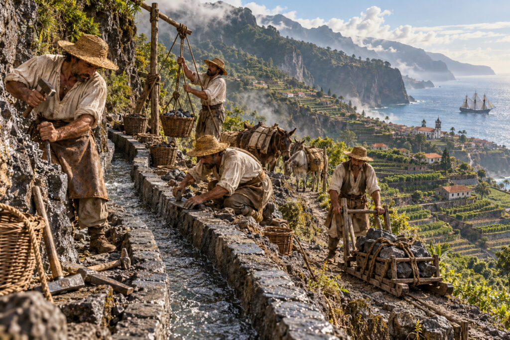
On the steep north flank of Madeira, rain falls hard and often. On the sunnier south coast, settlers needed that water to grow export crops. Beginning in the 16th century, colonists and local craftsmen cut narrow canals—levadas—into cliffs and through mountains to carry water from wet ravines to parched fields. The name itself comes from the Portuguese levar, “to carry.” What started as practical irrigation for sugar then wine, and later banana and vegetable plots, quietly reshaped where people lived and how the island worked.
Engineering, labor, and everyday ritual
Levadas are deceptively simple: an open channel, a shallow gradient, and a handful of tunnels and aqueducts where the rock demanded it. Yet building them meant hauling stone by hand, chiseling through basalt, and running tiny ledges along sheer drops. The network clipped into hidden corners—the sides of laurel forests, the rims of volcanic calderas—and linked tiny terraces and hamlets that would otherwise have been cut off.
Water became a form of local currency. Families kept to strict irrigation turns; maintenance was communal and seasonal; paths alongside the levadas were the island’s arteries for foot traffic and for moving fodder and tools. Those maintenance practices, and disputes over who got water when, are as much a part of Madeira’s history as the ships that carried its wine abroad.
From working infrastructure to wandering attraction
Through the 19th and 20th centuries the island’s economy shifted and roads and pipes changed some patterns of life, but the levadas endured. Walkers today follow routes that were first carved by farmers. Tunnels that once smelled of earth and sweat are now lit and signed for visitors, and the tiny walkways have become one of Madeira’s most distinctive kinds of slow tourism. That transition has not been purely romantic: tourists bring revenue and new pressures—erosion, safety upgrades, and debates about who controls access to the paths and the water they channel.
At the same time, many levadas remain working infrastructure. Farmers still rely on them in more remote valleys, and their continued upkeep ties a modern island back to older rhythms of communal labor and landscape knowledge.
Conclusion
Levadas are more than quaint hiking routes. They are visible records of how geology, crops, and human labor combined to make Madeira what it is: an island whose life depended on carrying water against steep odds. Walk one and you follow a map of decisions—and of daily work—made over centuries, where every narrow ledge still holds a story about place, survival, and shifting economies.