Places carry traces of political change, migration, and everyday routines across decades.
These traces form overlapping layers that shape how people remember, use, and value space.
Studying those layers requires attention to material remains as well as oral and archival traces.
This article outlines how scholars and local practitioners can read and interpret regional complexity.
Understanding Regional Layers
Regional histories accumulate through infrastructure, language, land use, and legal frameworks that often survive formal border shifts. A single field, road, or building can reveal connections between agricultural practice, commerce, and governance. Physical landscapes record adaptations: terraces, abandoned paths, reconfigured property lines and reused materials that speak to economic and social change. Interpreting these features demands linking material evidence with documentary records and lived memory. Local legal records often clarify ownership and dispute histories that landscapes alone cannot fully explain.
That linkage helps avoid simplistic narratives focused solely on maps or national frameworks. It foregrounds how people negotiated boundaries in daily life. This approach reframes regional change as an ongoing negotiation.
Everyday Practices and Memory
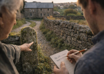
Everyday routines—markets, religious practice, schooling, and seasonal labor—embed regional belonging in habitual acts. Memory operates at multiple scales: family stories, local commemorations, and contested public monuments each carry selective recollections. Listening to a range of voices, including marginalized groups, reveals tensions between official narratives and lived experience. Attention to vernacular practices highlights continuity as well as moments of rupture. Attention to foodways and seasonal festivals often reveals long-term continuities and adaptations.
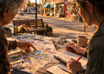
Museum displays, oral histories, and community maps offer entry points for these layers. They also show how memory is actively produced and negotiated. These platforms allow communities to contest and reframe official histories.
Methods for Local History Research
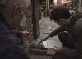
Researchers combine field survey, archival work, oral testimony, and spatial analysis to capture layered histories. Digital tools like GIS can visualize overlapping land claims and usage over time, while ethnography situates those patterns in practice. Small collections—school registers, estate inventories, trade receipts—often provide unexpected detail about mobility and exchange. Collaborative projects with local communities improve access to such materials and ensure interpretations are grounded. Training students in mixed methods helps sustain research capacity in local institutions.
- Field surveys to document structures and landscape features.
- Archival inventories and maps for legal and administrative history.
- Oral interviews and community mapping to capture memory and practice.
- GIS layers and temporal mapping to visualize change over time.
Ethical engagement, transparent methodology, and reflexivity are essential throughout. They help produce histories that serve both scholarship and local publics.
Conclusion
Reading regions as stacked histories opens more nuanced understandings of place and belonging.
It shifts emphasis from fixed borders to dynamic practices and tangible traces.
Such approaches enrich public dialogues and guide preservation, planning, and education.