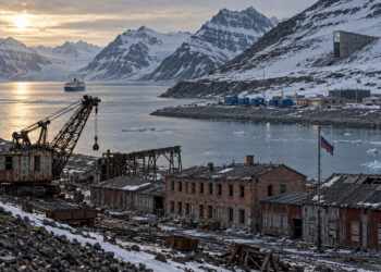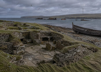


Regions are rarely fixed boxes on a map; they are palimpsests where human activity, environmental change, and memory accumulate over centuries. Understanding a region means reading its layered traces — field boundaries, settlement patterns, place names, and archival records — together rather than in isolation. This article explores how combining material evidence, cultural practice, and historical sources can reveal persistent regional identities and their transformations. It aims to offer practical perspectives for researchers, teachers, and curious readers who want to interpret landscapes as living historical texts.
The layered nature of regional landscapes
Regional landscapes form through long-term interaction between people and their environments, producing patterns that can persist even after political borders shift. Farmsteads, trade routes, and ritual sites often align with natural features such as rivers and ridgelines, creating durable spatial frameworks. These frameworks help explain why certain economic and social practices cluster in specific places across time. Reading layers requires an attention to both continuity and change, recognizing that later developments may obscure earlier ones.
Material and archival evidence in regional analysis
Material remains and documentary sources provide complementary windows into regional history, each compensating for the other’s silences and biases. Archaeological features, historic buildings, and landscape modifications reveal economic and technological shifts, while maps, tax lists, and personal correspondences record administrative choices and lived experience. When combined, they allow researchers to triangulate dates, functions, and social meanings attached to places.
– Historic maps can show the persistence of roads and property lines over centuries.
– Archaeological surveys reveal earlier land use that written sources ignore.
– Local archives provide names and narratives that anchor material traces in human stories.
Careful cross-referencing between these kinds of evidence builds robust regional narratives without overreliance on a single type of source. It also highlights where gaps remain and where further fieldwork or archival searches are needed.
People, memory, and local practices
Communities actively shape regional identity through storytelling, rituals, and everyday practices that encode history into place. Oral histories and folklore often preserve explanations for landscape features, sacrificial sites, or customary land divisions that are not present in official records. These living memories can guide researchers to overlooked sites and suggest meanings that material evidence alone cannot provide. Engaging respectfully with local knowledge enriches analysis and supports collaborative research.
Applying regional perspectives in research and education
Using a regional approach encourages interdisciplinary methods and helps students connect abstract history to tangible places. Field-based projects, map analysis, and archival workshops teach skills in observation, critical source evaluation, and synthesis across datasets.
– Design small-scale landscape surveys paired with archival assignments.
– Use community-sourced materials to teach about historical change on a local scale.
Such methods foster deeper historical thinking and produce narratives that resonate beyond academia.
Conclusion
Thinking regionally invites us to read the environment as an archive where material traces and human memories intersect. Combining evidence types and engaging communities produces richer, more nuanced histories of place that explain both continuity and change. Regional perspectives make history tangible and relevant to present-day landscapes.